

3-D mapping company EveryScape today launched its product for Boston, Miami, Aspen and New York. We’ve written a great deal about the potential for 3-D mapping to become a centerpiece of the local search experience in published reports and blog posts.
Most of that coverage has focused on Microsoft’s Virtual Earth 3-D, which provides an immersive 3-D mapping experience that lets you fly in and out of cityscapes and search for addresses and business locations. Google’s Street View, meanwhile, provides a first-person street-level perspective to go up and down streets in a growing list of U.S. cities.
EveryScape basically combines these and also has its own angle, in providing 3-D renderings of the insides of some buildings for users to browse. This gets a step closer to the transactional implications for 3-D mapping that we’ve explored in the past. For EveryScape, this is also a key element to its current revenue model.
“The product includes a self-service portal where a business owner can say, that’s my store and I really want to allow people to walk inside and see what it’s like,” says EveryScape CEO Jim Schoonmaker. “This can include putting in a ticket booth and selling tickets, or do whatever you want to do that is relevant to the business.”
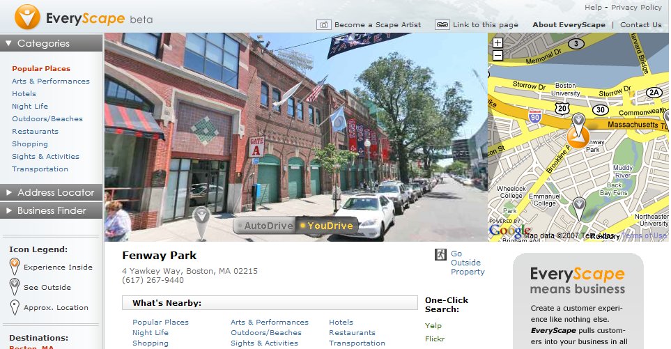
EveryScape Finds Fenway Park (click to expand)
The street-level 3-D mapping will integrate basic local listings data to have addresses and businesses that are searchable. But for interiors, the company will offer upsells (pricing here) that let advertisers show off the insides of their buildings or locations. This has clear opportunities and potential appeal for real estate and travel (think hotels), both of which EveryScape is targeting in bus dev efforts, according Schoonmaker.
“The three markets we’re most focused on are local search, real estate and travel,” he says. “The experience is suited to looking for restaurants in your neighborhood or restaurants in Miami where you are going to visit. Those markets weave together along with real estate, although real estate is the most distinct of the three.”
Schoonmaker took me on an interior walk-through of a two-bedroom suite of a Miami Hotel, which allowed me to walk around the room and out on the balcony with a user-friendly and graphically rich interface. This is basically what many of the 3-D walk-throughs introduced in online real estate search in the past have tried to be, but better.
Sweet Suite: An Inside Look at Miami Hotels (click to expand)
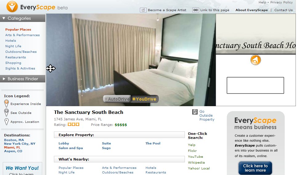
The interface includes a floor plan on the right side of the screen so you can also see where you are from an overhead perspective. There are also interesting user-centric features such as searches for nearby businesses, or the ability to go to other popular content sources to get more information on locations, such as reviews from Yelp, photos from Flickr, and videos from YouTube.
“Once you build the real world online, you have a photorealistic experience of interiors and exteriors. That is a platform upon which you can integrate all kinds of content,” says Schoonmaker. “For example, If you’re in a restaurant, you can add a link to OpenTable through an affiliated relationship with them.”
And with higher broadband deployments from telco delivered IPTV and bundled service packages, better imagery and functionality will be enabled, which will attract more users to 3-D mapping products like this.
“The quality of the photographs that we have are very detailed, but we have to downsample them pretty heavily to squeeze them through the pipes,” says Schoonmaker. “So just imagine how much better it could be with bigger viewers and more detailed pictures.”
Feet on the Street?
In order to make these interior 3-D renderings, the company sends photographers to the businesses that sign up for it. Similar to technologies employed by other 3-D mapping providers, it patches together these photo stills to form 3-D renderings to proper scale. Its exterior street-level maps are done in a similar fashion.
“One of the advantages of this process is that it’s very inexpensive to create,” says Schoonmaker. “It doesn’t require any video gear. It only requires a digital SLR camera to create this environment. Your Canon Digital Rebel is all you need.”
This differs from other 3-D mapping technologies in that it will also fill in some blanks in its 3-D cityscapes and building interiors by utilizing pictures that users (“scape artists“) will submit. It’s yet to be seen what the level of this participation will be, and if there will be varying quality of images submitted.
Nonetheless, the company has an interesting model and, what’s more, a compelling and functionally sound product in an area that will continue to receive increasing levels of interest from users and advertisers. For the time being, its biggest challenge could be reaching out to the fragmented small-business marketplace to communicate its sales message. Schoonmaker agrees that high touch sales channels are an advantage and he’s interested in talking to potential Yellow Pages channel partners, although the company will primarily rely on self provisioning and viral marketing.
“We tend to get a lot of viral momentum from the fact that we build your neighborhood online,” says Schoonmaker. “You can walk up and down your street and see your storefront and people naturally want to get connected to it. It’s not just about businesses in the abstract.”
EveryScape’s best strategy, given the real estate and travel opportunities, could be to reach out to more centralized sources of revenue such as national real estate agencies and hotel chains (strategy taken by Spot Runner). From there, it could get more bang for its promotional buck and more effectively put itself on the map. It will be interesting to see what kind of traction the company receives, and how the embryonic area of 3-D mapping continues to fuse together with local search.
This Post Has One Comment
Leave a Reply
You must be logged in to post a comment.
Wow, this is similar to MapJack.com